
By using rainfall data from the past two decades, the flood warning system will identify areas vulnerable to flooding. Currently, more than 200 sectors in India are classified as “major”, “medium” and “minor”. These areas pose a threat to 12,525 properties.
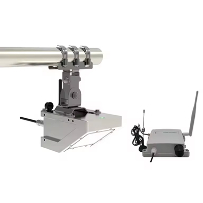
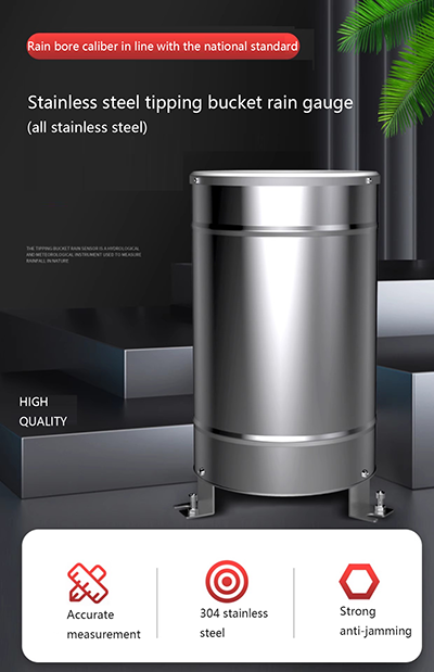
To gather information on rainfall intensity, wind speed and other key data, the flood warning system will rely on radar, satellite data and automatic weather stations. In addition, hydrological sensors, including rain gauges, flow monitors and depth sensors, will be installed in nalas(drains) to monitor water flow during the monsoon season. CCTV cameras will also be placed in vulnerable areas to assess the situation.
As part of the project, all vulnerable areas will be color-coded to indicate the level of risk, the likelihood of being inundated, and the number of homes or people affected. In the event of a flood warning, the system will map out nearby resources such as government buildings, rescue teams, hospitals, police stations and manpower needed for rescue measures.
There is a need to develop an early flood warning system to improve the resilience of cities to floods by integrating meteorological, hydrological and other stakeholders.
We can provide radar flowmeters and rain gauges with different parameters as follows:
Post time: May-21-2024